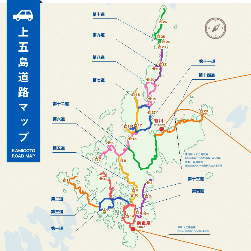
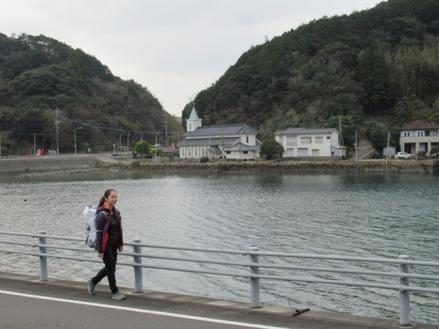
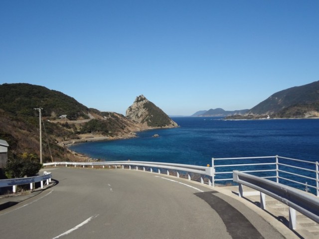
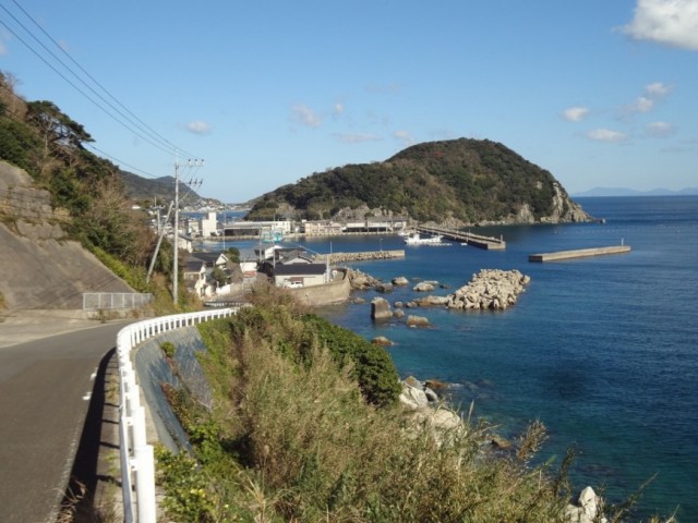
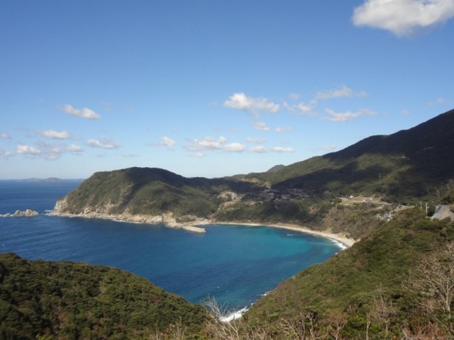
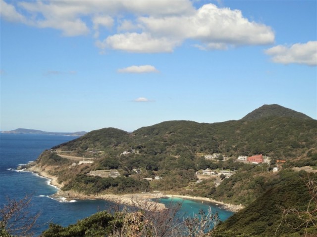
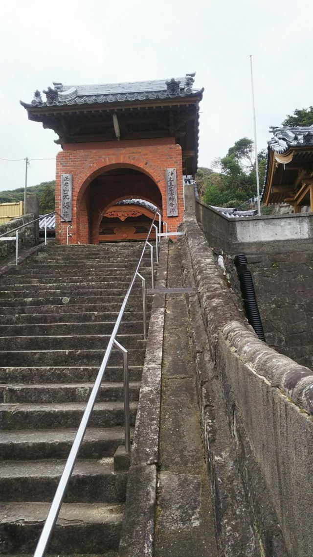
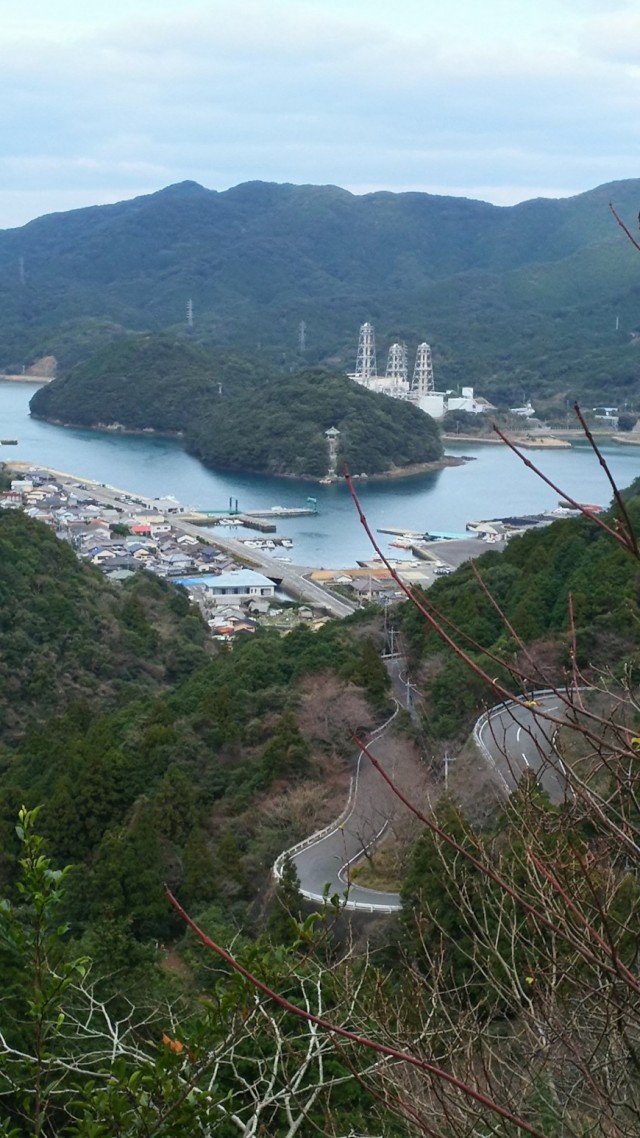
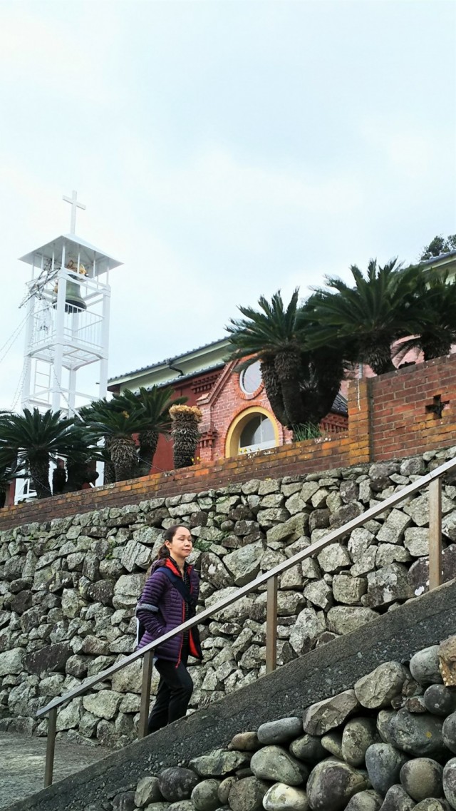
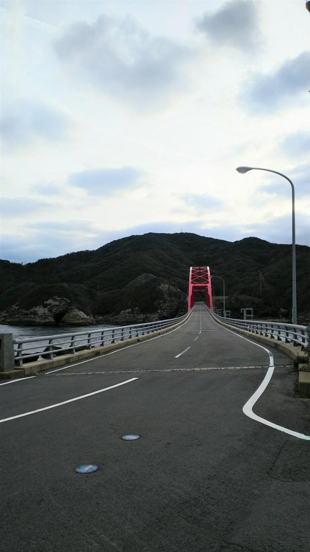
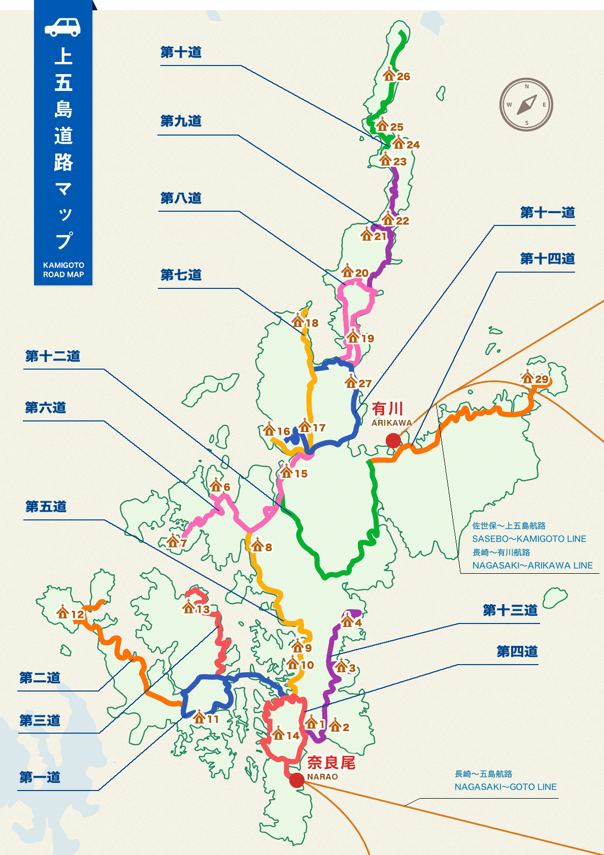
Upper Goto MAPTOP page > Upper Goto MAPUpper Goto mapNumber of way total distance about 188km of all 14 walk pilgrimage waysThe first way I go to the right left in the archipelago where a small island floats in the calm sea in Seto Degree of difficulty ★☆☆☆☆ Distance 12.4㎞ It is Doi no ura church 11 Other sightseeing spot Kirishitan Cave For more details, it is thisFor more details, it is thisFor more details, it is thisThe second way The way where the sea opens out, and history of the interchange with the continent is had a glimpse of by the way of 3m above sea level along the Rias coast Degree of difficulty ★☆☆☆☆ Distance 13.6㎞ It is Arifuku church 12 Other sightseeing spots day island music old grave group For more details, it is thisFor more details, it is thisFor more details, it is thisThe third way Way of traditional coming and going 18km that the sea occasionally appears and disappears on the thick way creeping over the mountains covered by Yamaki Degree of difficulty ★★☆☆☆ Distance 18.0㎞ It is Ohira church 13 Other sightseeing spot dragon Kanzan observation decks For more details, it is thisFor more details, it is thisFor more details, it is thisThe fourth way Including the torii of the noakou tree more than 650 years, it rotates before a history of a village and the deep sea fishing of kakurekirishitan (there is the cafe of the traveler welcome) Degree of difficulty ★★☆☆☆ Distance 14.8㎞ It is a paulownia church 14 Other sightseeing spot akou jushinura kakurekirishitan For more details, it is thisFor more details, it is thisFor more details, it is thisThe fifth way A national highway and the scenery along the spacious gentle shore while I look at Kojima floating in the sea spread Degree of difficulty ★☆☆☆☆ Distance 10.9㎞ It is Oura, Wakamatsu church no ura 10 both hands no ura 9 church 8 Other sightseeing spot Sannouyama Ichinomiya For more details, it is thisFor more details, it is thisFor more details, it is thisThe sixth way It is the west nose of the island in the point of the way of ups and downs to pass through the seashore, the mountains Degree of difficulty ★★★☆☆ Distance 15.7㎞ It is trace next *saki 15 wild boar no ura 7 church 6 Other sightseeing spot Heike mound Mifune For more details, it is thisFor more details, it is thisFor more details, it is thisThe seventh way I pass the fishing port and climb the person of rock Kannon and pass through the countryside, and a view reaches the good observation station while dropping in at the salt studio Degree of difficulty ★★★☆☆ Distance 13.0㎞ It is cold water blue 18 daihi 17 church 16 Other sightseeing spot arrows harder park arrow harder station For more details, it is thisFor more details, it is thisFor more details, it is thisThe eighth way A view opens the halfway up a mountain of the peninsula on the running way while going round the villages formed in ura々 of the peninsula Degree of difficulty ★★★☆☆ Distance 11.8㎞ It is Sone blue sand ka ura 20 church 19 Other sightseeing spot salt studio nature school fishing ports For more details, it is thisFor more details, it is thisFor more details, it is thisThe ninth way There are a way and a field and the sea living on the slope of the steep peninsula Degree of difficulty ★★★★☆ Distance 12.0㎞ It is kotai Ryo Ose 23 flooding 22 church 21 Other sightseeing spot fisheries processing ground second shrine Shrine For more details, it is thisFor more details, it is thisFor more details, it is thisThe tenth way I reach the north end of the peninsula in a way and a field and the point of the sea living in the steeper ground Degree of difficulty ★★★★☆ Distance 12.7㎞ It is Yoneyama relation intellect 26 red 25, Hae church 24 Other sightseeing spot Tsuwazaki Lighthouse Tsubaki Park For more details, it is thisFor more details, it is thisFor more details, it is thisThe eleventh way The way which coexists of the faith Degree of difficulty ★☆☆☆☆ Distance 8.3㎞ It is Maruo church 27 Other sightseeing spot Masahiko Shrine former sea temple For more details, it is thisFor more details, it is thisFor more details, it is thisThe twelfth way There is a superb view in the gap when I pass through the way along the mountain stream and the mountain village Degree of difficulty ★★★★☆ Distance 15.0㎞ It is sea bream no ura 28, Sanobara church 5 Other sightseeing spot Lourdes For more details, it is thisFor more details, it is thisFor more details, it is thisThe thirteenth way There is faith in the point going down the way of the halfway up a mountain of the mountain in the sea all over the country Degree of difficulty ★★★★☆ Distance 14.0㎞ It is senkomori the beach skewer 4 Takai trip 2 3, Fukumi church 1 Other sightseeing spot Kibonoseibo-zo For more details, it is thisFor more details, it is thisFor more details, it is thisThe 14th way The way which reaches a cathedral and the village of the world heritage Degree of difficulty ★★★☆☆ Distance 15.4㎞ It is head ka island church 29 takankojiharamishinsha For more details, it is thisFor more details, it is thisFor more details, it is thisMap downloadingPlot(85KB) Upper Goto road map(252KB) Every area glances through the accommodations The accommodations than this